 This was a backpacking and climbing expedition to Middle Palisade, California's 11th highest mountain,
on 8/31-9/3 (Friday to Monday), 2001. Middle Palisade is the 4th highest peak in the Palisade group of California's
eastern High Sierra region, after North Palisade (14242' / 4341m), Mount Sill, and Split Mountain; it sits on the
Sierra crest and has an elevation of 14012 feet, or 4271 metres. Vladimir Ulyashin and I succeeded in summitting Middle
Palisade on September 2nd, following a variation of the standard (class 3) climbing route up its northeast face.
This was the highest peak I have ever climbed so far, required the longest, toughest approach to reach the mountain,
and the difficulty of climbing was the highest (and most fun). However, although the steepness of the route was
unprecedented for me and the verticality of the views spectacular, we encountered far lower risks (loose, crumbly
rock, sharp flakes, icy glacier, etc.) than my previous trips to Kuna Peak, Mount Dade and Mount Abbot. This was
one of the most enjoying climbs I've had.
This was a backpacking and climbing expedition to Middle Palisade, California's 11th highest mountain,
on 8/31-9/3 (Friday to Monday), 2001. Middle Palisade is the 4th highest peak in the Palisade group of California's
eastern High Sierra region, after North Palisade (14242' / 4341m), Mount Sill, and Split Mountain; it sits on the
Sierra crest and has an elevation of 14012 feet, or 4271 metres. Vladimir Ulyashin and I succeeded in summitting Middle
Palisade on September 2nd, following a variation of the standard (class 3) climbing route up its northeast face.
This was the highest peak I have ever climbed so far, required the longest, toughest approach to reach the mountain,
and the difficulty of climbing was the highest (and most fun). However, although the steepness of the route was
unprecedented for me and the verticality of the views spectacular, we encountered far lower risks (loose, crumbly
rock, sharp flakes, icy glacier, etc.) than my previous trips to Kuna Peak, Mount Dade and Mount Abbot. This was
one of the most enjoying climbs I've had.
The standard approach route is from Glacier Lodge trailhead (west of the town of Big Pine) up the drainage of
the south fork of Big Pine Creek; total elevation gain to the summit is approximately 6600 feet over the 7-mile
approach. This is a larger elevation gain than any of my previous trips (my previous record was 5000 feet to Matterhorn
Peak). We planned to follow the standard northeast face route, rated class 3, as described in RJ Secor's guidebook
as well as in summitpost.com,
which contained more detailed descriptions of the approach, a map, and photos red-lined with the climbing route.
Since ascending Mount Abbot earlier this year I have been eager to do more class 3, which is not really dangerous
but much more fun than class 2. In order to plan for a very tough approach, we decided to arrive on Friday night,
camp on the road side, then start hiking on Saturday morning (after getting the wilderness camping permit). This
way we have all day to get as close as possible to the mountain. We would then set up camp at one of the highest
lakes in the drainage. On Sunday we would attempt to attain the summit, and on Monday we would hike out to the
car and drive home.
Things pretty much went according to plan. We arrived at my favorite roadside camp site at the end of Pine Creek
Road around 1 am on Saturday morning. The night was very bright with a full moon. Next morning we went to Bishop
to get wilderness permits, ate brunch, got some groceries, then drove to the trailhead (7600'), near the end of
Glacier Lodge Road from the town of Big Pine. We started hiking at around 12 noon. En route we noticed lots of
ripe wild berries hanging on the trailside bushes. We sometimes stopped to pick the small red gooseberry currants
(Ribes montigenum), which were juicy and delicious. We got off trail and climbed slabs toward the outlet
of Finger Lake, reaching there (10790') around dusk, where we saw half a dozen people camping. We decided to follow
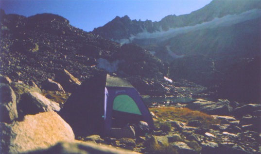
the ridge on the east (left) side of Finger Lake to the two small lakes higher up in the drainage. These two are
the highest possible places to camp, at about 11,380' and 11,520', respectively. Both drains the southern half
of Middle Palisade Glacier. As we proceeded upward, it was getting darker, and when the moon rose, the ridge we
were on was always in the shadow. However, flashlight was not necessary. We eventually reached a point where I
discovered a lake about 200 feet below on the right. We debated which one this was. I made the call to just go
down to it and camp there. It turned out this was the lower lake, at 11,380' elevation. It was probably around
9:30 pm. My hip joints were starting to feel clunky after almost 10 hours hiking and scrambling, overcoming about
4000 feet elevation in a single afternoon.
The night was much warmer than expected. Around 3 am both of us were sleepless so we got up to enjoy the moonshine.
I set up my camera to photograph the scene using long exposure. The photos turned out pretty cool. On Sunday we
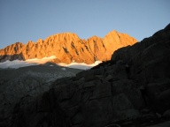
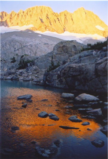
slept late in the morning, started climbing around 10:30 am. The lake was incredibly beautiful, with its calm waters
reflecting the majestic Middle Palisade and its glacier. The lake was a translucent aquamarine color because of
the "glacial till" (fine dust created by the glacier scraping rock beneath it) suspended in the water.
We passed by the upper lake, climbed up some grassy ledges, slabs, and finally the moraine separating the two halves
of Middle Palisade Glacier. The standard route does not traverse the glacier at all, which greatly reduces the
danger, especially late in the season when the surface becomes icy. On top of the moraine we met a party of 4 we
saw yesterday, who already descended the peak. They showed us a shorter class 3 route (with a photocopy of guidebook
pages in hand) to the left of the standard route, climbing up from the southern half of the glacier. They assured
us it was easy and they all went this way.
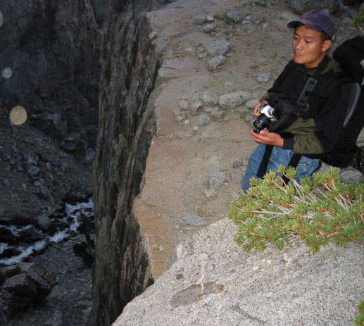
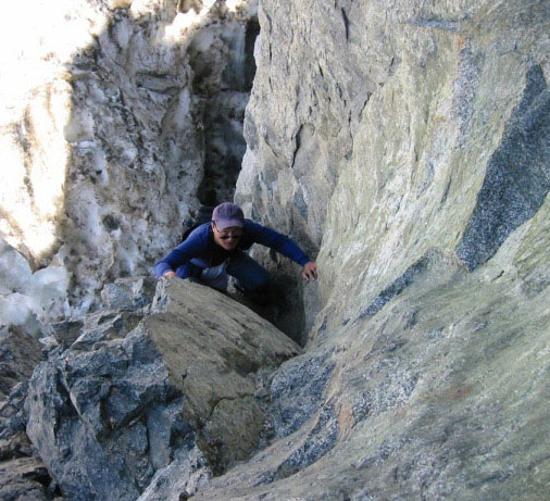
We decided to try this route variation. We followed their footprints which traversed the surface of the glacier
to the left of the moraine. After about 50 feet on the shallow sloped snow, Vlad saw a vertical crack leading up
the cliff. It looked like class 4 to me. I was a little uneasy of just trying any route, but on final assessment
decided to try, because the route recommended by the other party was not far away, plus I saw a "duck"
(a man-made stack of small rocks serving as route markers) there, so I was confident enough what lied above the
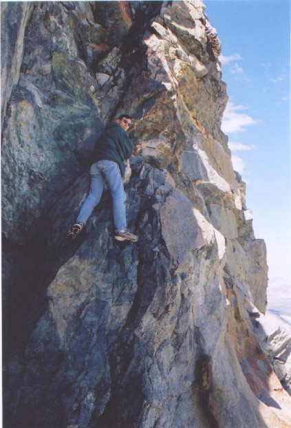
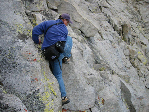
crack (which was not visible) would not be too difficult. It was slightly challenging but fun, and soon we found
it was indeed easier above. We're now on the left most chute whose top left pinnacle is the summit. The standard
route uses the next chute to the right, then merges with this one above a big buttress. The rock in this chute
has a slope of about 50-60 degrees, composed of mostly very solid granite slabs, with many cracks forming exellent
handholds and footholds. The absence of loose rock was wonderful, however, the steepness and the lack of wide ledges
was also frightening. The easiest climbing was mostly in the left side of the chute. Further left on the ridge
there are some great views down to the glacier, and the climbing was a lot of fun. We passed two descending parties
en route, one of which was a party of 2 with helmets and tied together with a rope; they caused occasional rock
falls, each time the rock would race down the chute for about half a minute, bouncing only a few times in the process.
Inside the chute we could look up toward the summit but couldn't tell whether there was more above or not. So when
I finally reached summit it was a surprise. Just below the summit there were some tall blocks difficult to surmount,
I instead found a easier way by traversing left. I reached summit at 4:10 pm, after climbing for 5 and half hours.
However we were not worried about time because the weather was quite clear and warm, and we knew there would be
good visibility under the moon.
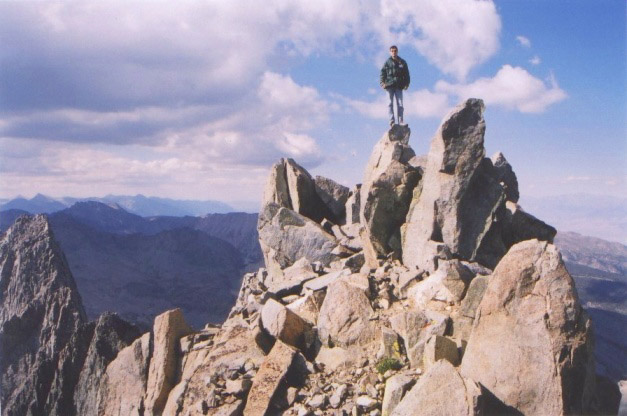
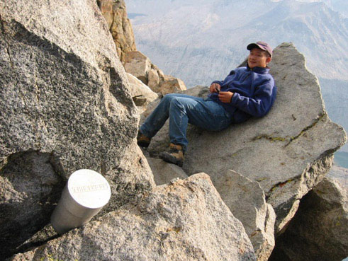
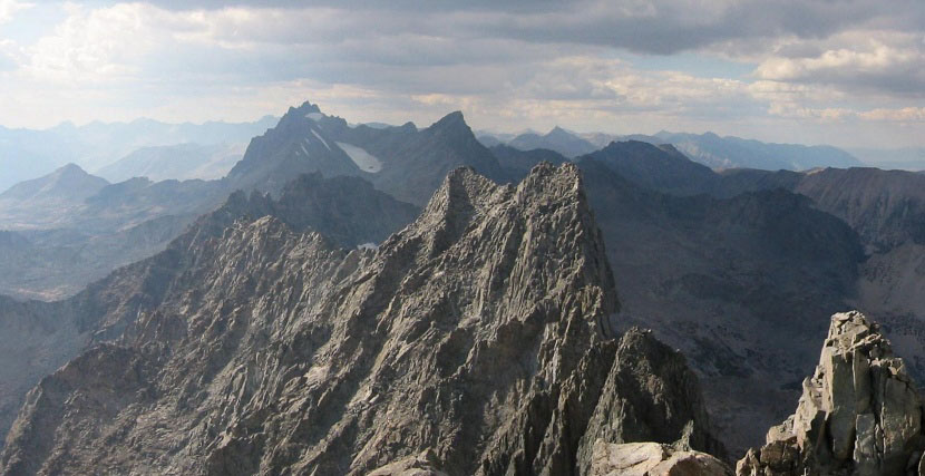
There was no one at the summit when we got there. We signed the summit register and took some panoramic photos.
Both of us also called friends on cell phone. Cell phone signals are always the best on the summit. The views were
fabulous, however there was dense haze on the west side of the crest, probably caused by multiple forest fires
on the Sierra's west slope. We stayed on summit for almost two hours, sunning and sleeping. At around 6 pm, we
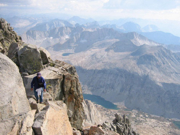
started to down climb the chute. The sun was starting to go down but it was warm enough. We followed exactly the
same way back, gingerly negotiated each small ledge, and reached the moraine at the bottom of the chute after 1
hour 40 minutes. Reaching the camp took another two hours, crossing a lot of unpleasant loose scree (gravel-like
rock piles) which we could not avoid because of darkness. My knees and ankles were overworked.
On Monday we hiked out, which was pretty uneventful except that we wasted about 2 hours on the trailside picking
currants. The best currants grew right at the base of big rock cliffs. I collected two bottles of it easily and
took them home. When we reached the car it was drizzling, and by the time we passed by Bishop for lunch there was
a heavy thunderstorm. The High Sierra peaks as well as the high White Mountain peaks were visibly covered with
white streaks - new snow. We were glad we weren't caught in it.
Here are some pictures from the trip:
