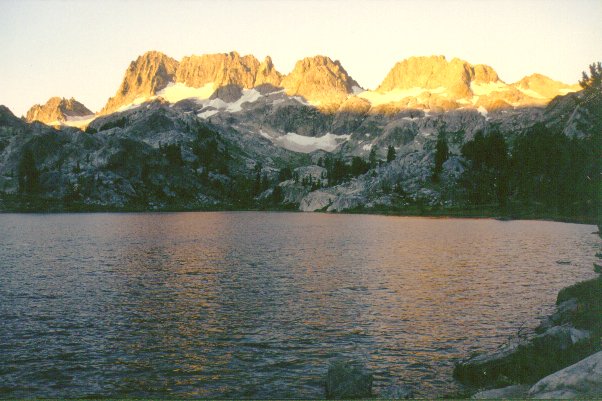
 This was a hiking and climbing expedition to Mount Ritter (13143 feet/4006 m), one of the
most impressive peaks in the High Sierra and the highest peak in the Sierra Nevada mountains north of San Joaquin River.
This majestic peak with its companion Banner Peak dominates one of the most
beautiful wilderness areas in California. I have for a long time wanted to climb Mount Ritter,
yet this peak presents several challenges: it has a fairly long approach (about 10 miles) and a substantial elevation gain
(about 5400 feet), it
also requires glacier-travel skills and gear for all times of the year. Being a popular mountaineering
peak, Mount Ritter has claimed numerous lives throughout the years. In addition, Mount Ritter is located
in a special administrative area where road access is restricted to a shuttle bus during summer days, presenting
another hurdle to climbers. Among all the challenges, the requirement of glacier-travel skills was most
critical for me. I had not been formally trained nor have much
experience on glacier travel, and the likelihood of death from a fall on an
icy slope or into a deep crevasse is high.
In the last year I have used crampons in my mountaineering trips,
giving me more
confidence in the use of crampons and ice axe on glaciers. Also the extremely wet season of winter 2004-05 (about 200% of normal snow fall)
resulted in full snow-cover conditions on most High Sierra peaks
during early summer, which could make things easier for mountaineers on
Mount Ritter.
This was a hiking and climbing expedition to Mount Ritter (13143 feet/4006 m), one of the
most impressive peaks in the High Sierra and the highest peak in the Sierra Nevada mountains north of San Joaquin River.
This majestic peak with its companion Banner Peak dominates one of the most
beautiful wilderness areas in California. I have for a long time wanted to climb Mount Ritter,
yet this peak presents several challenges: it has a fairly long approach (about 10 miles) and a substantial elevation gain
(about 5400 feet), it
also requires glacier-travel skills and gear for all times of the year. Being a popular mountaineering
peak, Mount Ritter has claimed numerous lives throughout the years. In addition, Mount Ritter is located
in a special administrative area where road access is restricted to a shuttle bus during summer days, presenting
another hurdle to climbers. Among all the challenges, the requirement of glacier-travel skills was most
critical for me. I had not been formally trained nor have much
experience on glacier travel, and the likelihood of death from a fall on an
icy slope or into a deep crevasse is high.
In the last year I have used crampons in my mountaineering trips,
giving me more
confidence in the use of crampons and ice axe on glaciers. Also the extremely wet season of winter 2004-05 (about 200% of normal snow fall)
resulted in full snow-cover conditions on most High Sierra peaks
during early summer, which could make things easier for mountaineers on
Mount Ritter.
With all these considerations Hakan and I planned
this trip to climb Mount Ritter over the Independence Day holiday weekend (July 2-4, 2005) with Ayla, his wife. Ayla was new to this kind of mountaineering
so she was fairly inexperienced. We would attempt Mount Ritter's Southeast
Glacier route with a difficulty rating of class 3, considered the easiest
route up the mountain. The standard route on Southeast Glacier is free of major crevasses, and
has a fairly gentle slope. Many people rope up when they climb glaciers
(especially in icy conditions, on steep sections, or around significant crevasses),
but on the Southeast Glacier climbers don't usually rope up in early season
when the glacier is covered by snow. This is what we planned to do,
so we didn't carry a rope to tether the three of us together on the glacier. This means if one person falls far on the glacier the whole team would have to descend to find him/her.
On Friday evening I rode with Hakan and Ayla to the Eastern Sierra and camped near the Mammoth Lakes
Ranger Station as usual, in order to get in line at 8 am for wilderness permits. Hakan already owns a
bear-proof cannister which fulfills the food storage requirements in the wilderness area along Shadow Lake Trail.
We obtained permits easily, as this year the back country conditions in early July was like May in normal
years, which had detered many people from going into the wilderness. We'd been told that there were extensive
snow cover along the Shadow Lake Trail, especially around the higher Ediza Lake (9000 feet), our planned camping spot.
We packed up our gear including ice axe and crampons for each person, then took the shuttle bus to Agnew Meadows
trailhead. Soon we saw occasional snow patches along the trail, and much swampy conditions due to the snowmelt.
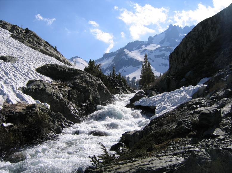
The further up we went the more pervasive the snow cover became. A mile before Ediza Lake, I tried to cross a creek
over a snow bridge but broke through and soaked my leg in the cold stream. We decided the best way was to remove our shoes to ford the
creek in a shallower section. There were a few other parties on the trail, but most didn't venture as high as we did.
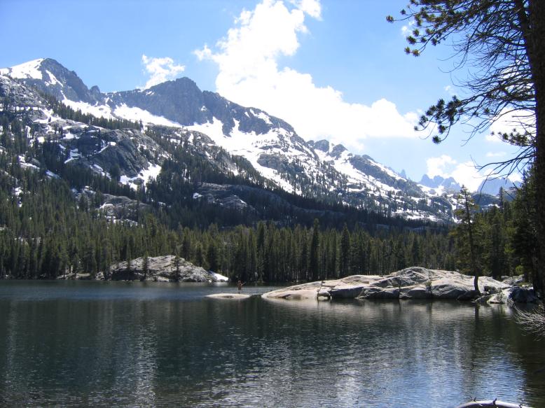
When we hiked along Ediza Lake's outlet stream in a narrow gorge, there was so much snow we needed to climb up on steep
rocks to avoid the sloping snow banks hanging over the raging torrents. As we finally made it to the shores of Ediza
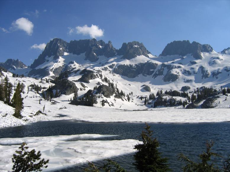
Lake the conditions were pretty shocking: the lake's shores were 95% covered by snow, with only a few patches of bare
ground around us. Half of the lake's surface was frozen. This contrasted sharply with the mild summer-like
conditions I encountered when I camped by Ediza Lake several years ago. The
conditions made me a bit leary of what lied ahead
in our trip.
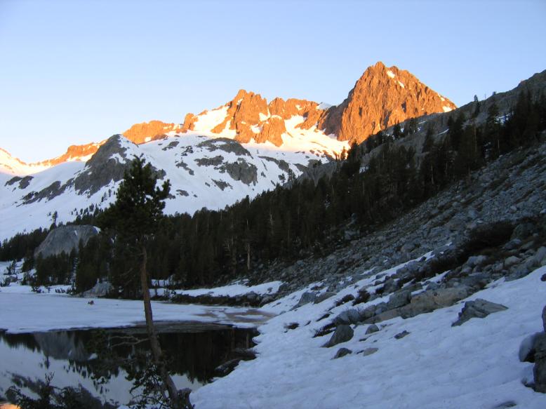
After we set up camp, the sun set and the air became very cold. I didn't expect such temperatures, but I wore my
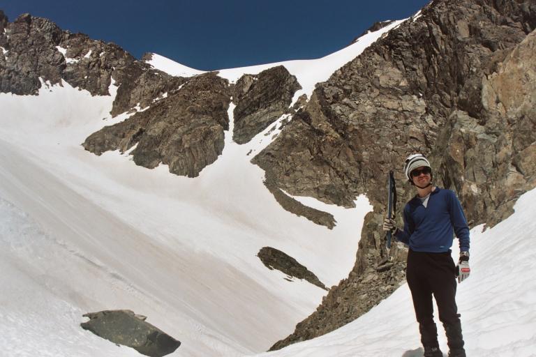
down jacket so no problems there. The next morning, we headed out with ice axe and crampons after the sun rose. The air
was crisp and chilly, but felt nice under the morning sun. We made our way quickly along the lake shore toward Mount Ritter
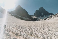
and soon entered the upper valley of Shadow Creek. Here the snow cover was 100% and deeply suncupped in most places,
ideal for cramponing. We followed Hakan's printouts of Alan Ritter's climbing instructions, and began climbing
the "lower gully", which was a snow chute at this time. The climbing was easy with crampons
as Hakan zig-zagged upward while I walked straight up the low-angle slope. At the top of the gully, we traverse to the right until we
were blocked by a buttress. There were two choices: either climb up the next chute on the left, which lead to the class 3 "Clyde
Variation" route, or descend and traverse further to the base of Southeast Glacier. Not wanting to lose elevation,
Hakan and I decided to follow the Clyde Variation route, which climbs a steeper snow chute left of the "Southeast Pinnacle".
Climbing up the snow chute was not difficult, and after an hour or so we made it to the saddle, from which we could
see the Southeast Glacier. The Clyde Variation route would traverse the glacier to the west, then climb up to the band of rocks
at the top of the glacier. As we rested, we saw two people skiing down the Southeast Glacier with graceful telemark
moves. After taking a few pictures at the saddle, we decided to start traversing the glacier.
The surface of the glacier ahead of me sloped down steeply toward the Southeast Pinnacle (about 60-65 degrees), and there was a longitudinal snow ridge
dividing this slope from Southeast Glacier proper, with a gentler slope of
about 40-45 degrees. I lead the traverse
and Hakan and Ayla followed. After about 10 steps, I felt the snow under my crampons gave way, and I started sliding
down quickly, gaining speed. I used my ice axe to dig into the snow, but the snow was so loose and fluffy
it was ineffective. In 2 seconds I had gained a lot of speed, and I tried frantically to dig in hard. Abruptly, my
crampons hit a set of rocks on the Southeast Pinnacle, but continued sliding. My speed had lowered somewhat due to the impact, then in a
split second my crampons hit a second set of rocks, causing me to come to a complete stop. I was stunned, and realized I was not even
wearing a helmet. The fact that I remained upright was what saved my life, as well as the fact that the rocks were close
enough to stop me without creating large impact forces. I had slid about 50 feet from the point where I lost traction. As
I recovered my senses, Hakan asked me if I was ok. I said yes, and immediately
put on my helmet. Hakan and Ayla carefully negotiated the steep rocks to approach me from above,
and we were able to talk. We decided to back-track to the saddle, climbing up the rocks along the edge of the glacier.
As I thought about what had happened, it was obvious that I lacked the experience to judge the safety of snow and
glacier conditions. Letting me to lead inexperienced climbers like Ayla was potentially very dangerous. Although in the past
I had enjoyed glissading down snow-covered glaciers, I was always in more benign locations with shorter slopes and
a safe catchment basin below. If I had slid down the main slope of the Southeast Glacier, maybe I would have stopped
after sliding down one or two thousand feet and be fine, but maybe I could have fallen over rocky cliffs and killed
myself. The difference between life and death is so subtle on glaciers it only depends on how fast you slide and whether you stopped
at the right place. After going through these thoughts I decided to turn back. Although Hakan wanted to explore other
options such as descending the snow to the main Southeast Glacier then climb up it, I decided it was way too dangerous
to subject inexperienced snow climbers (including myself, and especially Ayla) to such conditions.
As a consolation prize, Hakan decided to climb the Southeast Pinnacle, only about 100 feet above the saddle. Ayla followed his steps in the steep snow. As I followed them, I realized the snow was so soft it lacked
traction. I signaled Ayla that this was too dangerous and I was going down. Ayla agreed, but while trying to head down
she slid and fell about 10 feet, stopping after her legs fell into a hole between snow and a rock. She
was not hurt, but after this Ayla became frightened of the steep snow slopes, now softer and softer under the
summer sun. Hakan made it to the top of Southeast Pinnacle and descended without problems.
We decided to descend without seeking any more adventures, although a bit disappointing for Hakan. It was early afternoon but both
Ayla and I were freaked out by the treacherous conditions. During most of the descent Ayla held Hakan's hand
in order to feel safe, making it a slow descent. After traversing back into the lower gully, the terrain was
free of potentially fatal drop-offs, so I decided to glissade in some places. It was a lot of fun,
but the deep suncups often impeded my speedy descent. The afternoon in the sun and snow was very bright and warm.
We made it to camp before sundown, somewhat disappointed, but thankful that we were safe.
The hike out on Monday was long but uneventful, we made it to Agnew Meadows trailhead in early afternoon. This trip
was an important lesson to me and I would never underestimate this beautiful but treacherous peak.
Previous trip to this region: Backpacking to Minarets
Steve Dai and I backpacked to the Minarets-Ritter Range area of the High Sierra on July 28-29, 2001. This is
a popular backpacking area in Ansel Adams Wilderness southeast of Yosemite National Park, featuring beautiful glacial
lakes under the feet of dramatic high peaks such as Banner Peak, Mount Ritter, and the Minarets. We camped one
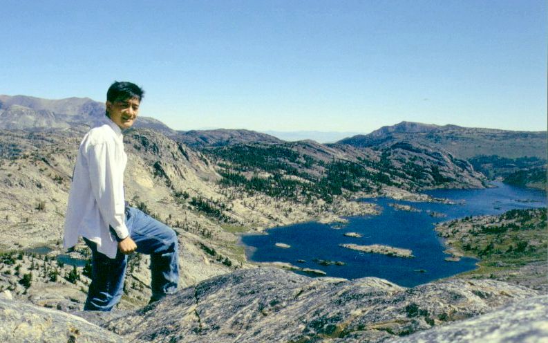
night at Ediza Lake, and walked by Shadow Lake, Nydiver Lakes, and I climbed to the top of a divide (10500ft. /
3200m.) separating the Garnet Lake basin from Nydiver Lakes.
